
![]()
This is a farming area, so please keep dogs under control at all times. Do not allow them to stray off the tracks, and please clean up dog litter.
In case of emergency please call 999 or 112.
Start / Finish: Croaghna Wood Carpark | GPS: 51.567340, -8.981769 | Distance: 2km | Duration: 40 minutes | Level: Moderate | Colour Code: Blue Arrows | Ascent: 50m
Starting from Croaghna Wood carpark, follow the blue arrows uphill through Coillte woodland. The old walls of Castlefreke estate are visible on your left as you walk uphill.
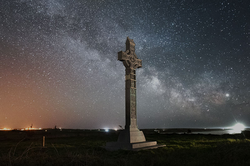
Follow the signs to Ireland’s tallest high cross, erected in 1901 as a memorial to Algernon, Lord Carbery, by his widow, Lady Mary. Spend some time looking at the beautiful carvings on the high cross and gazing at the magnificent views of the ocean, the lighthouse at Galley Head and the surrounding countryside before continuing downhill, turning left to return to Croaghna Wood carpark.
Lord Carbery’s high cross, the tallest memorial cross in Ireland at 9m (30ft), was erected in 1901 as a memorial to Algernon, Lord Carbery.
This Gaelic Revival-style cross was commissioned by his widow, Mary, Lady Carbery.
Carved in three sections, it features scenes illustrative of the Redemption, together with likenesses of St Patrick and St Fachtna. It is enriched with carvings representing angels, passion flowers, scallop shells, animal heads, winged griffons, Irish deer, wolfhounds and various birds, as well interlacings.
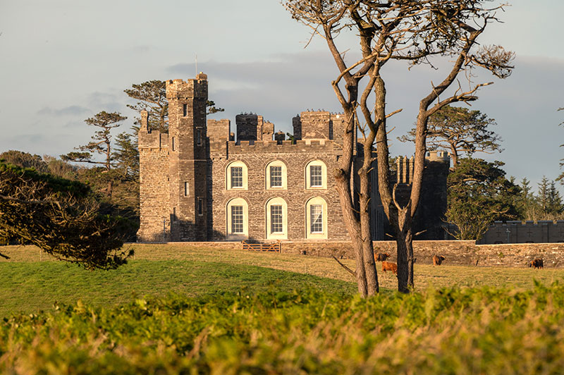
This country house (or castle) was built c.1790 by Sir John Evans-Freke to replace his earlier residence, the nearby 15th-century Rathbarry Castle.
Labourers who were working on the estate found an early medieval hoard of coins close to the house in 1799. These coins, which bore the names of Anglo-Saxon kings, were dated to the 10th century.
In the 1820s, the house was transformed by adding castellations, bartizans, castellated towers, a gateway and a portcullis. It was rebuilt in 1910 following a fire, but in 1919 it was put up for sale by the 10th Lord Carbery, at which point it ceased to be a residence. Instead, it was used for social events and by organisations such as the Irish Defence Forces and the Irish Countrywomen’s Association. (No public access.)
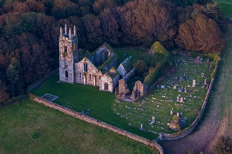
This graveyard contains two churches. The larger was built in the 1820s and is uncharacteristically ornate for a Protestant church of this date.
This was due to a considerable contribution by Lord Carbery. The church features a three-storey pinnacled tower and mosaic of religious motifs in the chancel. Lord Carbery and his family had their own entrance and seat on the northern side of the church. It closed for worship in 1927.
Nearby is an earlier, pre-Reformation church, with a 13th-century triple-lancet window at the east end. Documentation from c.1229 indicates David de Barry as the probable patron. The church was extended west in the later medieval period, and recent excavation revealed a 17th-century tower there. A mausoleum was built between the two churches some time after 1841.
The graveyard and earlier church contain gravemarkers and tombs of mainly 19th- and 20th-century date, with some 18th-century examples, the earliest being that of Sir Ralph Freke, who died in 1717. The medieval graveyard is still open for burials.
Long Strand’s curving barrier of sand stretches for almost 2km. Tradition has it that the dunes were formed by a tsunami in 1755.
This tsunami was caused by the Lisbon Earthquake. The foredunes were once mobile but have now been fixed under marram grass (Ammophila arenaria). However, erosion has increasingly become a problem as a result of trampling and winter storms.
The old Irish name for the western section of the strand is ‘An Cuar Leathan’ (The Wide Curve) and the eastern section was known as ‘An Cúl Tráigh’ (The Back Strand).
This coastal lagoon, along with Castlefreke dunes, is a designated Special Area of Conservation (SAC) because of its key habitats and wildlife.
It once had a navigable channel, now diverted into a culvert, which flowed from Rathbarry Castle to Long Strand.
Built c.1830 by Lord Carbery, this former gate lodge retains much of its original form, character and features. It displays fine craftsmanship throughout.
The early features preserved include rubble limestone walls, a canted bay window to the south, and a fine slate roof with rubble stone chimneystacks and timber bargeboards.
![]()
This is a farming area, so please keep dogs under control at all times. Do not allow them to stray off the tracks, and please clean up dog litter.
In case of emergency please call 999 or 112.
| Cookie | Duration | Description |
|---|---|---|
| cookielawinfo-checkbox-analytics | 11 months | This cookie is set by GDPR Cookie Consent plugin. The cookie is used to store the user consent for the cookies in the category "Analytics". |
| cookielawinfo-checkbox-functional | 11 months | The cookie is set by GDPR cookie consent to record the user consent for the cookies in the category "Functional". |
| cookielawinfo-checkbox-necessary | 11 months | This cookie is set by GDPR Cookie Consent plugin. The cookies is used to store the user consent for the cookies in the category "Necessary". |
| cookielawinfo-checkbox-others | 11 months | This cookie is set by GDPR Cookie Consent plugin. The cookie is used to store the user consent for the cookies in the category "Other. |
| cookielawinfo-checkbox-performance | 11 months | This cookie is set by GDPR Cookie Consent plugin. The cookie is used to store the user consent for the cookies in the category "Performance". |
| viewed_cookie_policy | 11 months | The cookie is set by the GDPR Cookie Consent plugin and is used to store whether or not user has consented to the use of cookies. It does not store any personal data. |